Sputnik and the Doppler insight (1957)
Within weeks of Sputnik 1's launch, two physicists at Johns Hopkins APL — William Guier and George Weiffenbach — noticed they could track the satellite by listening to its radio beacon and measuring the Doppler shift as it passed overhead. A colleague then asked the inverse question: if you know where the satellite is, could you locate the receiver? Within months they had the math for a global satellite navigation system.
Transit, Timation, and 621B (1959–1973)
The US Navy built Transit (1959) for submarine navigation — five satellites, fix every 90 minutes, accurate to a few hundred metres. The Air Force ran a parallel programme called 621B. The Naval Research Lab built Timation, which carried the first atomic clocks into orbit. In 1973 the Pentagon merged all three into a single programme: NAVSTAR-GPS.
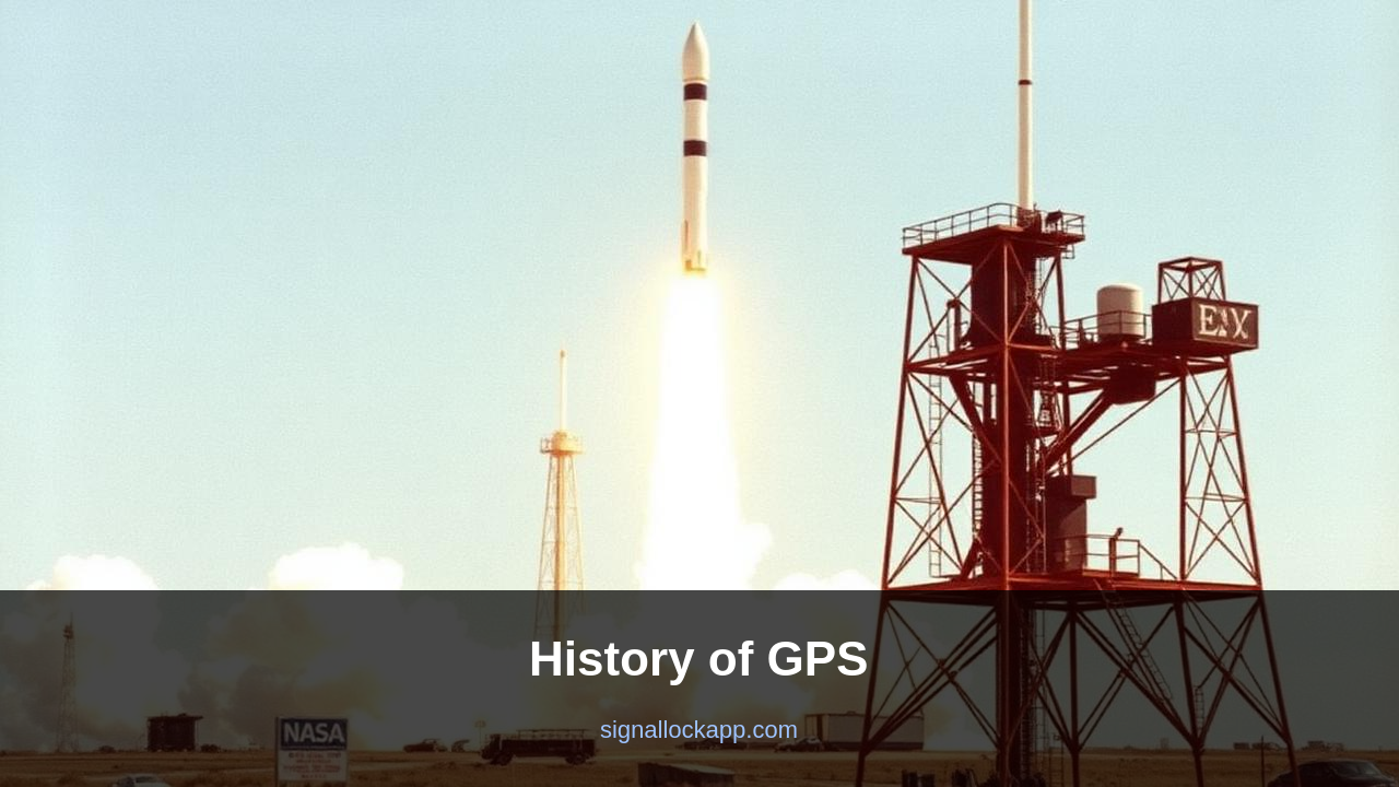
Launch and KAL 007 (1978–1983)
The first GPS satellite, Navstar 1, launched in February 1978. The system was meant to be military only. In September 1983 a Korean Air Lines 747 strayed into Soviet airspace and was shot down by a Su-15. The crew had no way to know they had drifted off course. President Reagan announced two weeks later that GPS would be made free for civilian use once it was operational. That promise turned out to be the foundation of the modern geolocation industry.
Selective Availability and its end (1990–2000)
Until May 2000, the Pentagon deliberately degraded the civilian signal — 'Selective Availability' — so that consumer GPS was accurate only to about 100 metres. President Clinton turned it off at midnight on 1 May 2000. Civilian accuracy improved 10× overnight. Every navigation app, ride-share company and food delivery service that exists today depends on that single decision.
What came next
Russia's GLONASS reached full coverage in 2011, the EU's Galileo in 2016, China's BeiDou in 2020. Modern receivers use all four constellations simultaneously — 100+ satellites visible from anywhere on Earth — and combine them with inertial sensors for sub-second fixes in tunnels and city canyons.
The Ground Control Segment and Relativistic Corrections
While the satellites are the most visible component, the Master Control Station at Schriever Space Force Base is essential for system integrity. This facility monitors the health of the 24 to 31 active satellites and uploads daily ephemeris data. Because the onboard atomic clocks move at 14,000 km/h and sit 20,200 km above Earth, they are subject to both Special and General Relativity. Special relativity makes the clocks run seven microseconds slower per day due to speed, while general relativity makes them run 45 microseconds faster due to weaker gravity. Without precise compensation for this net 38-microsecond offset, GPS positions would drift by more than 10 kilometres every single day.
To maintain this precision, ground stations in Hawaii, Kwajalein Atoll, Ascension Island, Diego Garcia, and Cape Canaveral act as fixed reference points. These stations measure the distance to the satellites with millimetre precision and communicate corrections back to the constellation. This feedback loop ensures that the 'L-band' signals—specifically L1 at 1575.42 MHz and L2 at 1227.60 MHz—carry the most accurate time-stamps possible. For civilian users, the addition of the L5 frequency in newer GPS III satellites provides better signal penetration in urban canyons and improved resistance to interference, marking the most significant technical upgrade since the system's full operational capability was declared in 1995.
The Block IIF Era and the Modernization Program
The evolution from the original Block I developmental satellites to the current GPS III generation describes a massive leap in longevity and signal power. The Block IIF satellites, launched between 2010 and 2016, introduced high-performance atomic clocks and a dedicated civil signal for aviation safety. These units replaced the aging Block IIA models that had exceeded their 7.5-year design lives by decades. The modernization was prompted by the increasing reliance of global financial markets on GPS time-stamps for high-frequency trading and the synchronization of cellular networks, where a discrepancy of even a few nanoseconds can degrade data throughput in 4G and 5G base stations.
Today, the system is no longer the only game in orbit. It operates alongside Russia's GLONASS, Europe's Galileo, and China's BeiDou in a multi-constellation environment known as GNSS (Global Navigation Satellite Systems). Modern receivers are typically 'multi-GNSS,' allowing them to track up to 30 or 40 satellites simultaneously. This redundancy is critical for autonomous vehicles and precision agriculture, where centimetre-level accuracy is required. Despite the competition, GPS remains the gold standard, maintained by the U.S. Space Force as a global public good, with current efforts focused on 'M-code' signals that provide enhanced anti-jamming and anti-spoofing capabilities for military operations in contested environments.
The Spread Spectrum Breakthrough
A critical technical hurdle for GPS was signal interference and intentional jamming. Unlike the earlier Transit system, which used simple continuous-wave signals, NAVSTAR adopted Code Division Multiple Access (CDMA) on a spread-spectrum signal. Developed by Brad Parkinson’s team and drawing on encryption research by Hedy Lamarr and others, this allowed all satellites to broadcast on the same frequency without mutual interference. Each satellite was assigned a unique Pseudo-Random Noise (PRN) code, a sequence so precise it functioned as both a timing marker and a signal ID. This innovation ensured the system could operate in electromagnetically dense environments while maintaining the high timing precision required for centimeter-level trilateration.
To synchronize these signals, the ground control segment must account for both General and Special Relativity. Gravity at orbital altitude (approx. 20,200 km) is weaker than on the surface, causing satellite clocks to run faster by about 45 microseconds per day. Conversely, their orbital velocity causes them to slow down by 7 microseconds per day due to time dilation. Without a combined correction of 38 microseconds daily, the calculated position on a receiver would drift by more than 10 kilometers in a single day. The Master Control Station at Schriever Space Force Base constantly adjusts these clock offsets to bring the space segment into alignment with UTC (USNO) standards.
From L1 C/A to the L5 Band
The original GPS signal, legacy L1 C/A, was designed in the 1970s and remains the most used frequency globally. However, it is vulnerable to ionospheric delay—the slowdown of radio waves as they pass through charged particles in the upper atmosphere. This delay introduces meters of error unless a receiver can compare two different frequencies to calculate the refraction index. Starting with the Block IIR-M satellites in 2005, the L2C signal was added, followed by the high-power L5 ‘safety-of-life’ signal on Block IIF. L5 resides in a protected aeronautical frequency band, offering higher bandwidth and a longer code cycle that makes it significantly more resilient to multi-path interference in urban canyons.
Modern receivers increasingly utilize these multi-band signals to achieve ‘Instant RTK’ (Real-Time Kinematic) precision without specialized ground base stations. While early civilian units in the 1990s were lucky to achieve 15-meter accuracy, a dual-frequency L1/L5 smartphone today can often resolve a position within 30 centimeters under an open sky. This evolution shifted GPS from a navigation tool for ships and planes into a ubiquitous sensor for autonomous drones, precision agriculture, and augmented reality. The transition to the GPS III generation, beginning in 2018, further improves signal strength and anti-jamming capabilities, ensuring the constellation remains competitive with international systems like Galileo and GLONASS.